Addition of King Air has increased flights in one of company’s busiest fire seasons in history.
According to predictions released in May 2021 by AccuWeather, the significant lack of precipitation in early 2021 set the stage for a dangerous fire season with more than 75% of the western United States experiencing drought conditions, 21% of which is under exceptional drought, which is the most extreme level, according to the U.S. Drought Monitor.
Infrared mapping is also used to map small and large wildfires, as well as black-line, cold-fire mapping, and new-start fire detection. In just the first half of the fire season, as of July 31, 2021, OAR has flown 267 missions, covering 178,316 acres, and 56 individual fires and complexes.
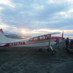
“The 2021 fire season has required the full extent of all the Owyhee Air aircraft, to include both of our P68 aircraft as well as our King Air special mission aircraft,” OAR President Michael Intschert said. “We are operating daytime missions for new start detection with our P68 aircraft — landing, recrewing and sending out the aircraft again in the evening for infrared fire mapping. With the King Air special mission aircraft we added this year, along with our P68 aircraft, we are able to be assigned more fires because of the increased capabilities.”
The addition of the King Air to the fleet brought a more capable aircraft in speed, altitude, and performance. The OAR King Air flight crews can fly multiple fires per night over a wider geographic area, allowing the OAR sensor operators and GISS personnel to deliver unprecedented amounts of data to local incident commanders and government GISS.
An example of OAR’s vigilance and dedication to wildfire support occurred on August 6 when the OAR infrared fire mapping flight crew was returning to home base when an airborne sensor operator saw a previously unknown, burning fire in the trees 9 miles northwest of McCall, Idaho.
“The OAR pilot called dispatch on the airborne FM radio system and relayed the coordinates provided by our MX-10 sensor of the new fire to incident command,” Intschert said. “Because of the Owyhee team’s quick thinking and immediate response, a Heliattack helicopter arrived on the scene just as our crews finished circling the fire.”
OAR works with Federal and state agencies, wildlife biologists, and fire managers throughout the United States and Canada, using the most advanced technology available in telemetry, infrared/HD video, and mapping equipment to conduct wildlife surveys, fire reconnaissance, and landscape mapping.
__________
About OAR
Owyhee Air Research (OAR) is a licensed FAA Commercial Air Carrier and approved contractor for multiple private, federal, state, and local government agencies, wildlife biologists, and fire managers throughout the US. OAR uses the most advanced technology available in telemetry and Infrared/HD video equipment to deliver a variety of imagery, information, and intelligence.